Another thing that I didn't fully understand before we started walking was why there was no record or map noting how far apart everything is. The different villages are only ever noted in hours of walking distance, and meters in height, never kilometers apart. The reason for that was soon made very clear. I'm fairly sure that about 99% of the trail we covered was steep stone stairways. In fact, just yesterday someone told me that between Hile and Ghorepani (our planned route for day 2 of the hike, later to be split into 2 days) there are exactly 4,400 stone stairs. Up. All up. That's why although these two towns aren't necessarily that far apart it still takes about six or seven hours to walk between them. Hence the time and verticle distance notation.
Of course, the cold and the exertion were both completely worth it. If you found your way here through google and are questioning hiking anywhere in the Annapurna circuit in January... I urge you... don't delay. Buy your tickets now.
And to all you buddies out there that don't know quite where to go next on your travels... make sure this place is at least on your list.
One of the major bonuses of doing this hike in January is that there are hardly ever other tourists around. This has a few major perks in itself:
1. With very few tourists out and about this time of year, the only traffic on the trail consists of water buffalos and their babies, sheep/goat parties, donkey trains, and pony parades. Most of them wear fancy hats.
2. All the locals out on the trail are carrying huge loads (up to 100 kg) in rocks and other building materials in baskets strapped to their heads... making you feel like a giant whimp every time you start feeling tired. It's very motivating. They are much faster than us.
3. More monkeys come out to play when more people aren't around. But watch out... they're mischievous little buggers.
THE TREK
DAY 1.
Acclimatization Day
Drove from Pokhara to Nayapul. Walked from Nayapul (1070 m / 3510 ft) to Hile (1430 m / 4691 ft).
Up 4 Hours
Up 4 Hours
DAY 2.
Never Ending Stairs Day
Trekked from Hile (1430 m / 4691 ft) to Banthanti (2210 m / 7250 ft).
Up 3 Hours
DAY 3.
Never Ending Snowy Stairs Day
Saw stars from Banthanti (2210 m / 7250 ft) to Ghorepani (2860 m / 9383 ft).
Up 4 Hours
DAY 4.
Snowed In Day
Meandered around Ghorepani and took photos. Sans packs. Wonderful.
All Around Free Hours
Up 4 Hours
Snowed In Day
Meandered around Ghorepani and took photos. Sans packs. Wonderful.
All Around Free Hours
DAY 5.
Never Ending Icy Stairs DayHuffed from Ghorepani (2860 m / 9383 ft) to the top of Poon Hill (3210 m / 10531 ft).
Up 1 Hour
Then "slowly slowly" back down to Ghorepani (2860 m / 9383 ft) and "slowly slowly" back up to Deurali Pass (3180 m / 10433 ft).
Down and Up 3 Hours
Then slid back down to Tadapani (2630 m / 8628 ft).
Down 5 Hours
DAY 6.
"Nepali Flat" (Beginning and Ending in Similar Height) Day
Walked from Tadapani (2630 m / 8628 ft) down to Ghurjung (2050 m / 6725 ft)
Down 2 Hours
and back up to Chomrong (2360 m / 7742 ft).
Up 3 Hours
DAY 7.
We're Close Enough to Base Camp Day
Altered course and went from Chomrong (2360 m / 7742 ft and about negative 6 degrees celsius) away from base camp (4130 m / 13549 ft) to Jhinu instead (1780 m / 5839 ft) and to the hot springs there.
Best. Decision. Ever.
Free Hours
DAY 8.
Five Star Luxury Day
Stayed an extra day in Jhinu. Stayed most of the extra day in the hot springs.
Free Hours
DAY 9.
Manifest Another Monkey Party Day
Stayed another extra day hoping to hot spring it up with frolicking monkeys again. Guess lightning doesn't strike twice after all.
Free Hours

DAY 10.
My Legs Aren't Sore Anymore! Day
Walked from Jhinu (1780 m / 5839 ft) down to New Bridge (1340 m / 4396 ft)
Down 1.5 Hours
and back up to (Tolka (1700 m / 5577 ft).
Up 2.5 Hours
DAY 11.
My Legs Are Sore Again Day
Walked from Tolka (1700 m / 5577 ft) to Pitam Deurali (2100 m / 6889 ft)
Up 1 Hour
to Dhampus (1650 m / 5413 ft).
Down Two Hours
DAY 12.
Mischievous Monkey Day
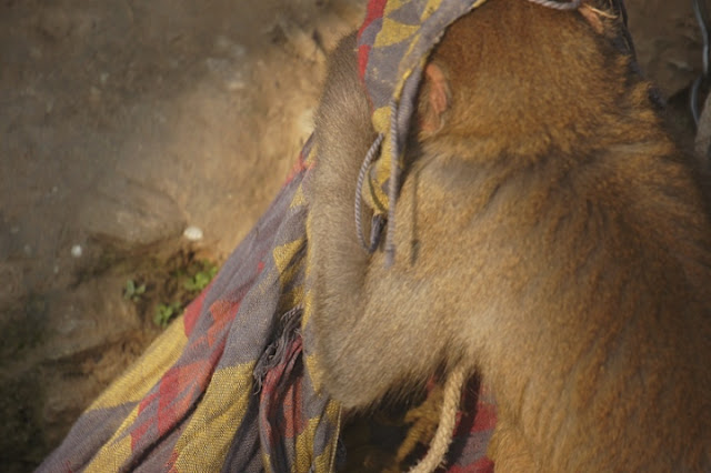
A monkey on a leash nearly strangled Kris with his own scarf because he wanted it so badly. Need today have any other notation? Oh yeah... and we finished the trek.
Fini.
Except one last note...
Our good new Nepali friend, Niches, has a wonderful guide company if anyone is interested in looking into a simple and easy way to book any trip in and around Nepal...
find him at www.ganeshhimaltrekking.com
DAY 9.
Manifest Another Monkey Party Day
Stayed another extra day hoping to hot spring it up with frolicking monkeys again. Guess lightning doesn't strike twice after all.
Free Hours

DAY 10.
My Legs Aren't Sore Anymore! Day
Walked from Jhinu (1780 m / 5839 ft) down to New Bridge (1340 m / 4396 ft)
Down 1.5 Hours
and back up to (Tolka (1700 m / 5577 ft).
Up 2.5 Hours
DAY 11.
My Legs Are Sore Again Day
Walked from Tolka (1700 m / 5577 ft) to Pitam Deurali (2100 m / 6889 ft)
Up 1 Hour
to Dhampus (1650 m / 5413 ft).
Down Two Hours
DAY 12.
Mischievous Monkey Day
A monkey on a leash nearly strangled Kris with his own scarf because he wanted it so badly. Need today have any other notation? Oh yeah... and we finished the trek.
Fini.
Except one last note...
Our good new Nepali friend, Niches, has a wonderful guide company if anyone is interested in looking into a simple and easy way to book any trip in and around Nepal...
find him at www.ganeshhimaltrekking.com


Great photos.
ReplyDeleteDear travelers,
ReplyDeleteNamaste and warm Greetings from Himalayan Country Nepal!!
My name is Sanjib Adhikari. As an independent trekking guide and tour operator in Nepal, I would like to welcome everyone in my motherland country, Nepal. With the keen interest in the adventure tourism, I have been involved in this field at a very young age. Pursuing my career in different capacities as porter, assistant guide, I have developed myself as an independent trekking guide and leadership in various outdoor activities. Licensed and fully certified from the Government of Nepal, we plan and guide for exploration and adventure throughout Nepal.
A little history about my trekking experience:
I myself have been over expeditions to Mera peak, Island peak, Kalapathar, Gokyo peak, Tseryo RI and across many high passes in Nepal, Larkye Pass, Ampulapcha Pass, Chola pass, Renjula pass, Tashilapcha pass, Ganjala pass, Thorong La pass, Tilicho pass, (Mesokantola pass). Within the long span of an adventurous journey, I have extensive guiding experience on Mt. Kailash, Lhasa in Tibet also Ladak and Sikkim in India. Enrollment for 7 years long journey gives me courage to work out for an independent organized trekking agency.